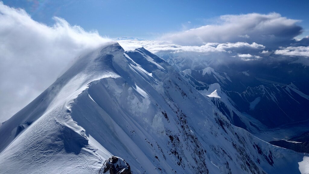
Pik Pobeda 7439 meters

Address
Contacts
Phone number not specified
Business hours
Business hours unknown
Directions
13 reviews
August 16, 2024
I was on the Peak. I like it, but I don't recommend climbing it, and I won't go there myself. ))) It's very very very hard. Kommunizma Peak better

14
February 14, 2024
Altitude above sea level: 7439 m. Since 1938, the Peak of the 20th anniversary of the Komsomol, since 1943, the Peak of Military topographers, since 1946, the Peak of Victory. It was first conquered in 1938 by Soviet climbers, who gave it its first name. The second ascent took place only in 1956, and later the peak was conquered 11 more times. The spherical panorama can be viewed here http://baikal360.org/пик-победы-360-сферическая-панорама/
See original · Русский
13
1
April 25, 2022
the view is beautiful, but it's cold
and it's very difficult to get there for a long
time and it's very difficult to need good alpine equipment and a lot of effort for this hike
, it's difficult to find a group that will decide on such a difficult hike
by the way * the phone refused to work at such a height * there are no photos *
See original
8
13