Add an item
selo Dorgeli
selo Dorgeli, selskoye poseleniye Dorgeli, Karabudakhkentskiy District, Republic of Daghestan
Coordinates:
clipboard
Search nearby
Places to visit
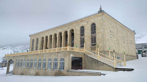
Центральная Джума-мечеть
Центральная Джума-мечеть
24 hours
Republic of Daghestan, Karabudakhkentskiy District, poseleniye Dorgeli, selo Dorgeli
Мечеть Джума
Мечеть Джума
Business hours unknown
Republic of Daghestan, Karabudakhkentskiy District, selskoye poseleniye Dorgeli, selo Dorgeli, ulitsa Sharafutdina
Мечеть Сафар
Мечеть Сафар
Business hours unknown
Republic of Daghestan, Karabudakhkentskiy District, selskoye poseleniye Dorgeli, selo Dorgeli